Neighborhood History
From Narrioch to Coney Island
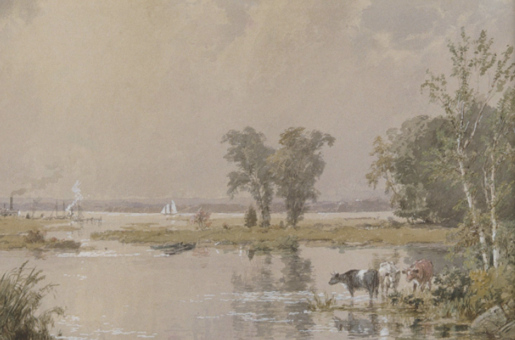
Before European contact, the area was home to the Lenape people, who called it Narrioch, meaning “the land without shadows”—a reference to its open, sunlit beaches along the Atlantic coast (NYC Municipal Archives, 2019). The island’s salt marshes, dunes, and tidal inlets supported a thriving coastal ecosystem and sustained Lenape communities through fishing and seasonal migration.
Dutch colonizers arrived in the early 1600s, and by 1645 claimed to have “purchased” this southwestern section of Brooklyn from the Lenape (Travel Thru History, n.d.). They named it Konijn Eiland, or Rabbit Island, for its abundance of wild rabbits—a name later anglicized to Coney Island. That same year, English settler Lady Deborah Moody and her group of religious dissenters founded the town of Gravesend, the first English settlement in Brooklyn. The land charter granted to Moody included Coney Island, though Indigenous residents disputed the colonists’ claim to their ancestral lands of Narrioch.
Image Source: Center for Brooklyn History

-
![]()
The island’s salt marshes, dunes, and tidal inlets supported a thriving coastal ecosystem and sustained Lenape communities through fishing and seasonal migration. Source: (Metropolitan Museum of Art) Marsh Lands before industrialization in 1890
-
![]()
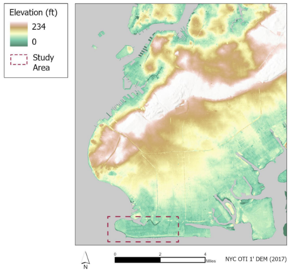
Approximately 20,000 years ago, the Earth’s warming incited glacial retreat, and the immense pressure of glacial melt carried sediment across the terrain (NYC Parks, n.d.), with its peak at 200+ ft above sea level, declining towards the shoreline.
-
![]()
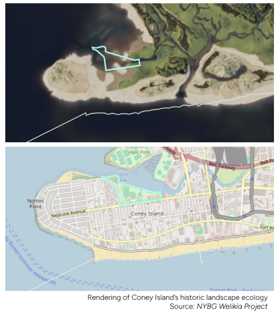
Coney Island Creek has been a dumping ground for raw sewage and industrial pollution for centuries (Spivack, 2021). While the passing of the Clean Water Act in 1972 prevented further contamination, government agencies have failed to reconcile the toxic conditions of the creek.
Rise of Resorts and Early Amusements
In the early nineteenth century, Coney Island was still considered a remote stretch of sand and marsh at Brooklyn’s southern edge. Its transformation began with new transportation infrastructure that connected the peninsula to the growing northern metropolis. A steamboat ferry, launched in 1845, followed by a rail line in 1864, opened Coney Island to visitors seeking leisure beyond the industrial city (Coney Island History Project, n.d.). These innovations in mobility marked the beginning of its rise as a seaside resort and a symbol of modern recreation.
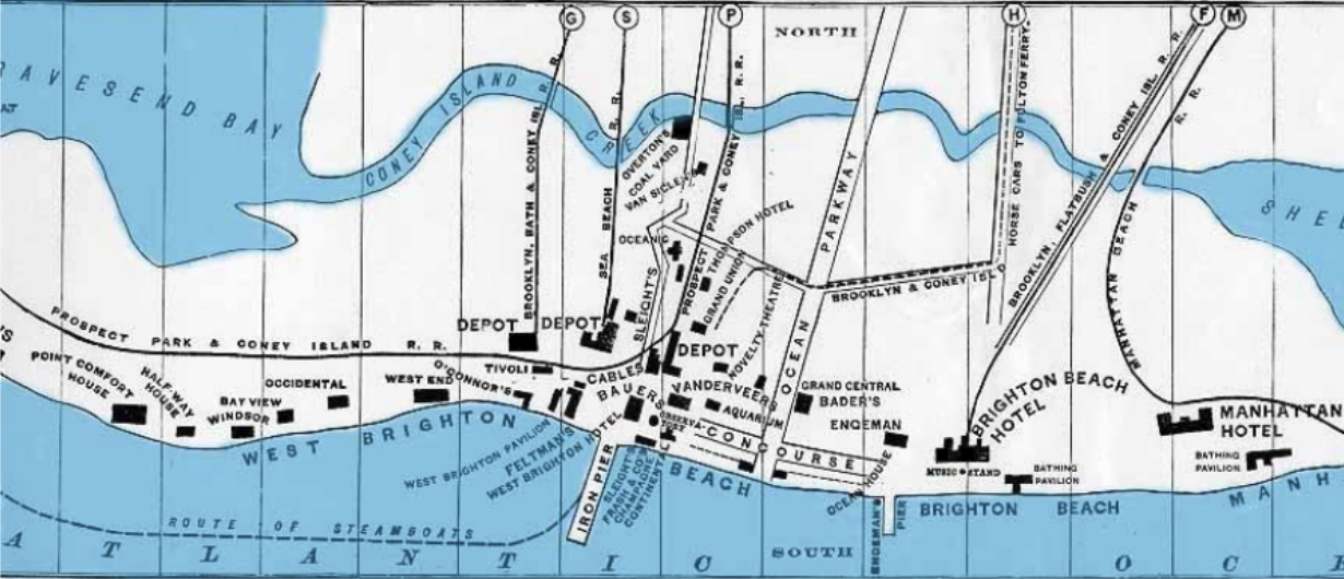
Map of transportation routes to Coney Island in 1879. Source: (Jeffrey Stanton)
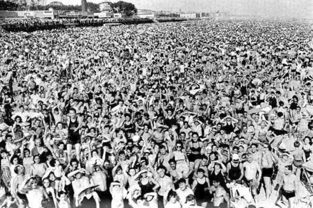
Coney Island hosted more than a million people on summer weekends in 1940. Source: (Jeffrey Stanton)
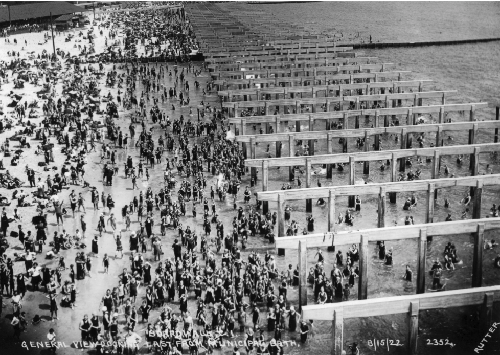
View of beach and boardwalk construction, August 15, 1922. Shot by E. E. Rutter. Source: (BK Mag)
Disinvestment and Development
In 1937, Robert Moses became head of New York City’s Parks Department, wielding New Deal federal funds to remake the city’s infrastructure. His planning philosophy prioritized automobile travel and imposed racially and economically segregated patterns of development. Coney Island quickly became a target of Moses’s redevelopment agenda. In a 1937 letter to the mayor, he dismissed the area’s cultural legacy, writing, “There is no use in bemoaning the end of the old Coney Island fabled in song and story. The important thing is not to proceed in the mistaken belief that it can be revived” (Kasson & Bennett, 2019, p. 224).
While the amusement district continued to attract visitors, Moses’s policies contributed to governmental neglect of Coney Island’s residential West End. The Federal Housing Administration redlined the neighborhood, making it nearly impossible for residents to secure loans, mortgages, or insurance. On the 1938 Home Owners’ Loan Corporation (HOLC) map, most of Coney Island was graded “D — Hazardous,” marked in red as Area D23. The accompanying survey described the area’s “mixed population” and proximity to amusement uses as “detrimental influences,” language that coded class and racial bias.
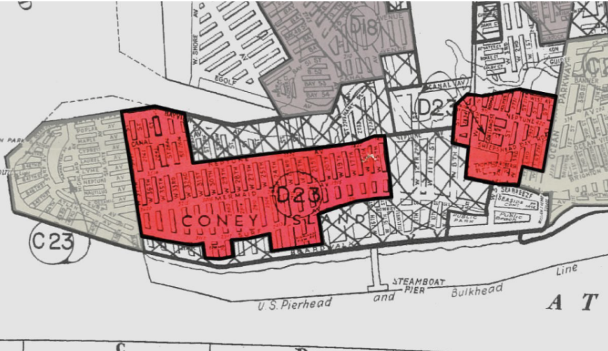
Areas in red situated where mixed demographics were considered “detrimental” Source: (Mapping Inequality)
1960s Redevelopment Plan
The 1960s redevelopment plan aimed to transform Coney Island into a family-friendly urban destination. This ambitious initiative proposed demolishing older amusement structures to pave the way for high-rise apartment buildings, shopping centers, and parking facilities. However, the plan encountered significant opposition from preservationists dedicated to safeguarding the island's historic amusement parks. Ultimately, while some alterations were made, the plan was scaled back, preserving iconic attractions such as the Wonder Wheel and the Cyclone roller coaster. Nevertheless, the mid-20th century marked a notable shift in Coney Island's cultural and architectural landscape, with the development of modernist housing. Significant public housing projects, including the Trump Village Towers, emerged during this period. These high-rise buildings provided essential urban housing and reflected changing societal expectations and living standards.
2009 Rezoning: Renewal and Future Growth
The 2009 rezoning initiative aimed to revitalize Coney Island's economy and enhance its appeal as a tourist destination. This plan introduced updated zoning regulations to facilitate mixed-use developments and higher-density housing. It emphasized infrastructure improvements and sustainable practices, ensuring that Coney Island is well-prepared for the challenges and opportunities of the 21st century. The initial phases of development included a blend of residential, commercial, and entertainment projects, some of which balanced modern requirements with the preservation of the area's historic character.
2012 Superstorm Sandy
Community Resilience and Future Growth
Environmental pressures came to a tidal head, during 2012 Superstorm Sandy. With flooding approximately 11 feet above ground level, 50,000 homes left uninhabitable, and 1,203 residents left without heat and hot water. Being deeplt neglected by the city and FEMA responders in the area, longstanding residents were forced to active off-grid, hyperlocalized means for sustenance, including emergency food access, health care, and evacuation support.
Across decades, community institutions have sustained a culture of connection. Entertainment and educational spaces such as the Coney Island History Project and the Coney Island Library preserve the neighborhood’s shared memory and serve as gathering points. Social service organizations, including the YMCA, and Neighborhood Housing Services anchor daily life with programs for youth, seniors, and working families. Grassroots groups such as the Coney Island Beautification Project and Friends of Kaiser Park continue to weave environmental care and mutual aid into local development and daily life.